
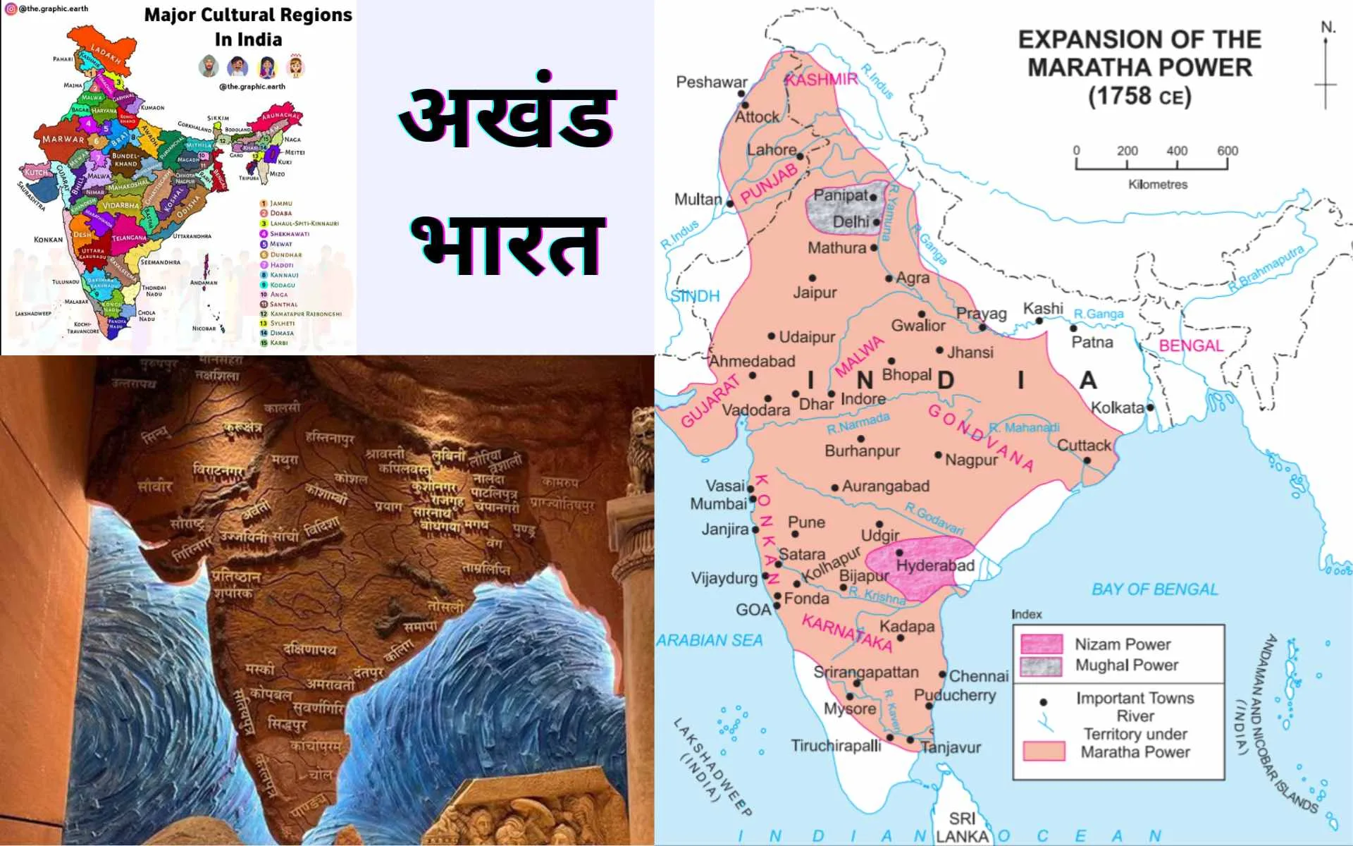
Akhand Bharat is the name of the political entity that represents the greatest extent of Indian cultural influence. This entity has been achieved numerous times in history, but partially during the Mauryan Empire, Maratha Empire, and a few other instances.
The names of the comprising entities, i.e., states and provinces at different stages of history, have been given below.
Ancient Akhand Bharat
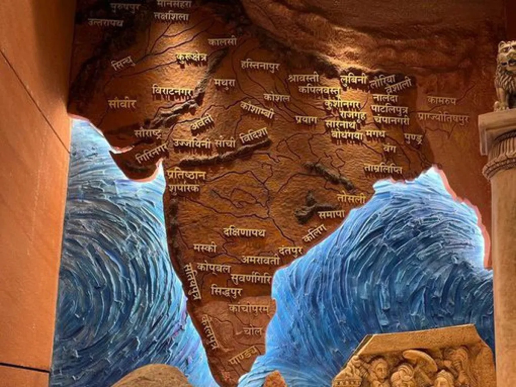
Here are the names of the regions that composed Akhand Bharat during Ashoka’s reign, going from North to South:
West of Aravali
- Mansehra
- Takshashila
- Purushpur
- Uttarapatha
- Kurukshetra
- Sindhu
- Viratnagar
- Sauvir
South Peninsula (Independent)
- Keralpura
- Kanchipuram
- Chola
- Pandya
Northern Plains
- Mathura
- Hastinapur
- Kaushal
- Kaushambi
- Prayag
Western Peninsula
- Saurashtra
- Girinagar
- Avanti
- Ujjayini
- Sanchi
- Vidisha
- Pratishthan Suparak
Magadha Region
- Shravasti
- Kapilavastu
- Kushinagar
- Rajgriha
- Sarnath
- Bodh Gaya
- Lumbini
- Laurya
- Vaishali
- Nalanda
- Pataliputra
- Champanagari
- Magadha
- Vanga
- Tamralipti
- Pundra
Assam Region
- Kamrup
- Pragjyotishpur
Peninsular Region
- Tosali
- Samapa
- Kalinga
- Dantpur
- Pratishthan
- Suparak
- Dakshinapatha
- Mashki
- Kopbal
- Satiyaputra
- Suvarnagiri
- Amravati
Most of these cultural regions still exist, like Kanchipuram, Tamralipti, Amravati, Kannauj, Sarnath, Pataliputra (Patna), and others.
Akhand Bharat Under the Maratha Empire
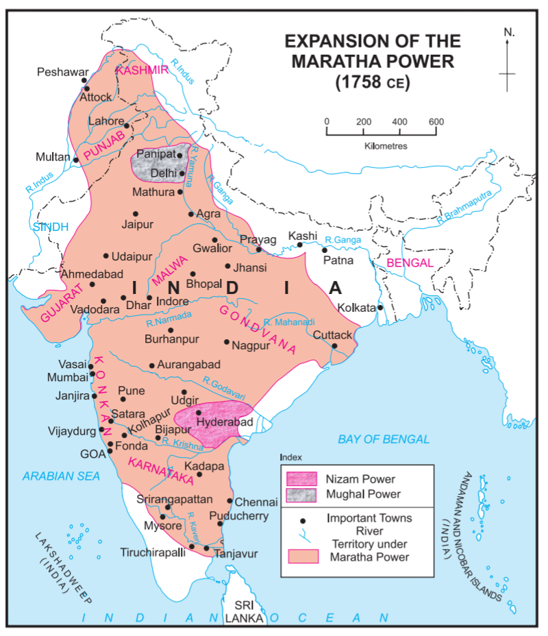
Below are the names of the states that represent regions of the Akhand Bharat under the Maratha Empire.
- Kashmir
- Punjab
- Gujarat
- Malwa
- Gondwana
- Konkan
- Karnataka
- Gangetic Plains
- Deccan
- Utkal
Regions that were out of the Maratha empire’s dominion were:
- Pandya
- Travancore
- Mughal Delhi
- Nizam’s Hyderabad
- Kalinga
- Bengal
- Assam
Modern Day Akhand Bharat
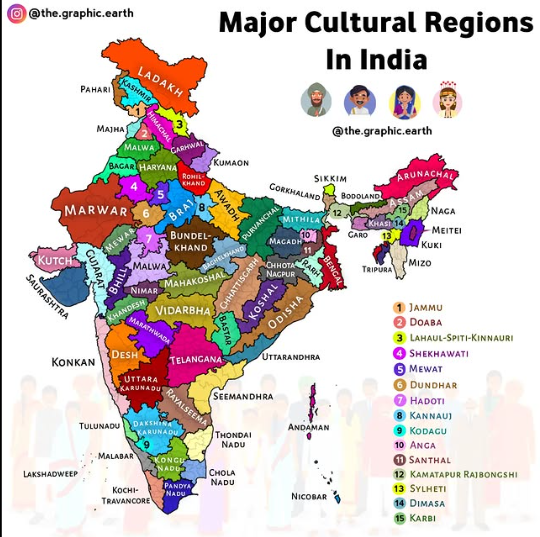
East India
- Odisha
- Kosha
Ganga Plains
- Braj
- Kannauj
- Awadh
- Purvanchal
- Mithila
- Magadh
- Anga
West India
- Kachh
- Saurashtra
- Gujarat
- Konkan
- Bhil
Tamilakam
- Kongu Nadu
- Chola Nadu
- Pandya Nadu
- Thondai Nadu
North Himalayan Cultures
- Himachal
- Lahaul Spiti Kinnaur
- Garhwal
- Kumaon
- Pahari
- Kashmiri
- Ladakh
- Gilgit
- Balti
Panjab Plains
- Doaba
- Malwa
- Majha
- Jammu (Dogri)
- Haryana
- Mewat
Deccan Cultures
- Bastar
- Desh
- Khandesh
- Telangana
- Marathwada
- Vidarbha
Andhra Coast
- Seemandhra
- Rayalseema
- Uttarandhra
Rajputana
- Marwar
- Bagar
- Shekhawati
- Dundhar
Karnataka
- Uttara Karunadu
- Dakshina Karunadu
- Kodagu
Western Ghats
- Konkan
- Malabar
- Tulu Nadu
- Kochi Travancore
- Lakshadweep
Central India
- Mahakoshal
- Nimar
- Malwa (MP)
- Bundelkhand
- Baghelkhand
- Hadoti
Chota Nagpur
- Chhota Nagpur
- Santhal
Bangla
- Rarh
- Bengal
- Kamatpur Rajbongshi
- Sylheti
- Andaman Nicobar
NE Plateaus
- Khasi
- Garo
- Karbi
- Dimasa
East Himalyan
- Sikkim
- Bodoland
- Gorkhaland
- Arunachal
East Him Tribes
- Naga
- Meiti
- Kuki
- Mizo
